Eyes on Wildfire
Q&A with Anke Sielker, Head of Re/Insurance Practice, ICEYE, and Virgile Salmon, Parametric Underwriter, Liberty Mutual Reinsurance
Liberty Mutual Reinsurance has launched building-level parametric wildfire coverage in the United States, Canada, and Australia based on the ability of ICEYE satellites to identify which individual structures among potentially thousands have been damaged by a blaze.
That capability has already been proven—ICEYE correctly identified more than 90% of buildings destroyed by the Pacific Palisades and Eaton fires last year in California even before the fires were extinguished.
Q
Tell me about Liberty Mutual Re’s parametric products and the new wildfire coverage.
A
VIRGILE SALMON: Liberty was one of the first movers in parametric. We are present everywhere in the world. In less developed countries, Liberty has worked with governments almost from the start on a number of parametric programs. There is a strong need for wildfire coverage in South America and Australia, tropical cyclone coverage in the Caribbean and Mexico, and Europe for flood, hail, and drought products. Now, we are using our worldwide experience to specifically target the U.S. commercial insurance market, where we have five main products we want to deliver. Those would be tropical cyclone, earthquake, severe convective storm, flood, and wildfire.
Wildfire has always been one of the most requested alternative risk transfer products by private companies, mostly on the forestry side. We have often received property-based requests, but the technology was not sufficient [for building-level coverage]. We have worked with Sentinel-2 satellite imagery [from the European Space Agency], but there were two main challenges. One is spatial resolution. Sentinel-2 is 10-meter resolution, which is impressive but not small enough for the resolution that we need at a building level. The other is the revisit time [the time between satellite imaging of the same location on Earth]. With ICEYE, we are able to provide really rapid information about the potential loss at a location, and given that it’s synthetic aperture radar data, we’re able to view it through night and through clouds.
Q
How does that technology enable this new wildfire coverage?
A
ANKE SIELKER: There are a lot of significant developments on the technological side that have enabled a wildfire parametric solution now. There are three major segments. One is the satellite capability itself: having a synthetic aperture radar satellite that can go down to a resolution level of 60 centimeters is one of the requirements. The second is the data archive. We have mapped enough wildfires now to have Liberty be able to work with an archive [of ICEYE wildfire data] to confirm the pricing, to confirm the triggers, and to confirm that in the areas where we are offering the coverage, we’re able to map all the wildfires in question. The third is the processing infrastructure. You need to have the data available through the satellites and the ability to translate it to wildfire-caused damage, but then also you need a team that has the processes in place so that we can deliver the data at the speed that is required for the transactions.
We have 76 satellites launched as of this week [in early July], and that means we can revisit, in terms of imagery, every place on Earth eight to 15 times a day. Most of the places on Earth we’ll get to a frequency of revisits that enables us to see them at least every hour [as the company launches more satellites]. That allows us in the case of wildfire to see through the smoke while the fires are ongoing and give indications whether a building on the ground is destroyed or not.
Geographically, ICEYE is launching coverage [with Liberty Mutual Re] across the U.S., Australia, and Canada currently, markets where the wildfire risk is the highest and where we have a strong data foundation. We can expand [coverage areas] rapidly with the constellation that we have wherever we have good building footprint data. For example, Europe is a good territory to look at.
Q
Who can benefit from the wildfire product?
A
SALMON: It’s a commercial solution. We are definitely not aiming for homeowners directly. We are going for the commercial level up to the reinsurance level. We are looking at portfolio-wide coverage. We could consider real estate management firms or owners, homeowners associations, especially in wildfire-prone regions, and insurance companies that may have a strong exposure in some locations. We would target their specific high accumulation or exposure part of the book.
The parametric solution is not in any way a replacement for the existing traditional indemnity-based coverage. Overall, there are three added-value parts to our parametric offering. One is excess capacity. It’s often the case in some peak risk-prone regions that they just want to buy additional capacity. The second part is the insurance gap. In some cases, brokers or clients realize that there is an insurance gap, which is why they go to alternative risk solutions, of which parametric is one. Lastly, it’s a really rapid solution. Some clients may suffer a strong catastrophic event, and they will be indemnified, but in 12 to 18 months. Some clients do not have the cash to cover those losses. The ICEYE product is maybe one of the fastest that we have on our shelf. In a couple of days, we have everything that we need to send a payout.
How does the payout work? It’s a binary structure, meaning that if there is a wildfire, we will get a report, and if there is no difference in the observation of the [state of the] building, it would be a null [no claim]. But if there is a difference, and ICEYE confirms that there is a loss, that the building is damaged, it’s 100% of the sublimit associated to this building. There is no almost damage or half damage, it’s 100% of the sublimit insured.
Q
Why is the level of detail important?
A
SALMON: It’s really important to avoid the basis risk, and it’s something that we reviewed when we analyzed past events. The basis risk is the difference between the actual loss suffered by the client and the one that can be claimed under a parametric policy. [This] can be different and this is something that we do not want to be exposed to. We really want to capture the cadastre [building footprint data], in order to confirm if there is a before-and-after difference in terms of [satellite] signal, and it’s really important to be sure that this is the exact building.
SIELKER: From our perspective, most of the parametric products use a proxy parameter that could be rainfall indices, vegetation scores, or wind speeds. Here, we see the actual damage to the property. First of all, we will confirm ahead of this policy being written that we can see this property from space. When a wildfire happens, we have trained our algorithm on the radar image to identify whether a building is destroyed, or likely destroyed, or likely not destroyed. The way a backscatter [rebound of radio signal to the satellite] from radar works is that the image that we receive of a structure that has been destroyed versus a structure that is undamaged is completely different. The impact of the fire on the structure will be well seen on the radar image. We are identifying the change to the building, and we’re guaranteeing that that change comes from a wildfire.
Two factors are primarily important. Number one is what we call the revisit rate, which is essentially the frequency at which we can take imagery of a certain location. If a wildfire happens, we want to guarantee that our data showing there is damage caused by wildfires is caused during the wildfire not a couple of days or weeks later.
The second piece is the accuracy of that image, that it shows damage to a building and not just a large area. The fact that we can image the same location multiple times a day during an event is what enables this from a technological point of view. The synthetic aperture radar enables us to see through smoke and at night. We don’t have to wait till the sky clears or until the fire changes direction. We can image in near-real time during the event. And our data will not only be used to enable policy payments, it’s also going to be used by emergency operations on the ground.
Q
How did ICEYE imagery from the Pacific Palisades and Eaton fires contribute to creating this product?
A
SIELKER: We looked at the Palisades and Eaton fires together with the team at Liberty, and those are just two examples of wildfires we’ve used for back-testing the solution. When we talk about the Palisades Fire, we have above 90% recall, which means of the buildings that are actually impacted, we correctly identified more than 90% as destroyed or undamaged. For the Eaton Fire, we had a recall above 95%. In terms of precision, we’re at 99%, which means we’ve virtually eliminated false positives. When we say a building is likely destroyed, that means essentially that we’re highly unlikely to be wrong in our assessment. This is hugely important for the basis risk. We’re not saying, “Liberty, please pay out when you shouldn’t pay out,” and vice versa. With this rate of accuracy, there is very low basis risk for the insured that they wouldn’t be paid out as well.
In the media, we’ve all seen the Palisades and Eaton fires. But if you ask our wildfire analysts, they’ll say those are just two of the many events we have mapped. We’ve mapped 914 wildfires from 2023 to present in the U.S. and Australia. That’s taking into account that we’re not mapping smaller wildfires that are not in proximity to any properties.
Q
What other parametric possibilities are satellite Earth observation capabilities opening up?
A
SIELKER: We currently map multiple natural hazards. We have a wildfire product, a flood product, and an earthquake product, and we’re going into other natural hazards to observe the damage there. We have a tropical cyclone product, which particularly now with the hurricane season ahead, we’re very much looking forward to seeing that adopted more widely in the market.
Looking ahead, essentially everywhere physical damage is visible from space, we can observe it. With that data, we can develop a parameter around it. I personally see this data source always being used alongside other parameters and other observation techniques. I don’t see satellite Earth observation as the single source. It’s likely going to be very often used as a hybrid trigger, and I look forward to seeing a lot of these structures emerging. That can be other types of sensors on the ground.
And then last, but not least, ICEYE itself will launch way more satellites with a higher revisit rate, so more images at a higher frequency, at a higher resolution. All of that will just make sure that for multiple of those periods, we’re coming to an accuracy threshold that will make this technology acceptable in commercial areas. And I think that’s what’s going to change trust and buying behaviors.
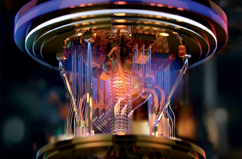
Quantum Leaps
Quantum computing is making a huge leap in public awareness as well as public and private investment. The technology holds the promise of major advances in chemistry, medicine, material science, fusion energy, and even insurance, by solving highly complex problems beyond the reach of today’s most powerful computers.
That, however, will require developing and building large-scale quantum computers that are fault tolerant, that is, less prone to errors than existing systems. IBM has set a 2029 target date for establishing the first such system. Toward that end, the tech giant plans to invest more than $10 billion in quantum computing over the next five years.
“The quantum era is no longer ahead of us, it has started,” IBM Chairman and CEO Arvind Krishna said in a June 2026 press release. IBM boasts the world’s largest fleet of quantum computers, in countries including the United States, Germany, Japan, South Korea, and Spain.
Quantum computing is based on the principles that govern how matter and light act at the smallest level, where things get weird. While traditional computer bits register either 0 or 1, quantum computer bits, or qubits, can be both at the same time. Harnessing this strange phenomenon can lead to vast improvements in computing power and speed. But qubits are sensitive to environmental disruptions, such as heat and electromagnetic fields, that lead to errors, which makes it essential to develop fault-tolerant quantum computers.
In insurance, Allstate and IBM have shown how quantum computing may help to optimize a portfolio of homeowner policies more quickly than relying on, say, a simulation of 100,000 scenarios using today’s computers. The work involved adapting the “knapsack problem,” filling a theoretical container with the most valuable items without exceeding a set weight limit, to insurance portfolios to best balance risk management and customer needs.
The White House has made developing quantum computing technology a national priority. In June, the Trump administration announced two executive orders, one demanding a new national quantum strategy and other measures designed to keep the United States at the forefront of quantum research and development, and the other directing federal agencies to adopt cryptographic standards capable of defending against quantum-enabled cyber threats.
IBM is working with the U.S. Commerce Department to launch the world’s first quantum wafer foundry, Anderon. The company will commit $1 billion in cash to the venture, with the government providing $1 billion in incentives as part of $2 billion in overall funding for quantum companies.
Among other efforts, the National Institute of Standards and Technology is establishing the Quantum Manufacturing Engineering Center to accelerate the production of quantum components in a project with research and development organization SRI International.